Make Your Way (MYW) is an active and sustainable travel focussed programme, enabling people to walk, wheel and cycle for everyday journeys in rural South Lanarkshire. Launching in 2016, Make Your Way has delivered 26 local active travel mapping initiatives, nine Sustainable Travel Action Plans, three Concept Designs and a Feasibility Study for rural active travel paths, a Feasibillity Study for Speed Reduction and Pedestrian Safety measures, plus the installation of benches, bike racks and a solar powered bin.
Current projects 2025/26
Community Action Lanarkshire (CAL) are progressing two Make Your Way projects which have been funded from the South Lanarkshire Renewable Energy Fund and the Community Led Local Development Fund. This support enables us to create Make Your Way maps and map boards for Strathaven, Chapelton, and Drumclog/Gilmourton. Make Your Way: Leadhills - Wanlockhead Active Travel Pathway Stage 3 Detailed Design and Stage 4 Technical Design, previously funded by Sustrans Places for Everyone programme. Now funded by Transport Scotland via Strathclyde Partnership Transport (SPT Make Your Way: Upperton - Greengairs Active Travel Pathway Stage 3 funded by Transport Scotland via Strathclyde Partnership Transport (SPT).Previous projects.
2025 seen the opening of the new Auldtoun–Douglas via Coalburn 10k Active Travel Path spearheaded by Community Action Lanarkshire in partnership with the local communities of Coalburn and Douglas. The new route, launched on 15 November 2025, makes it easier and safer for people to walk, wheel and cycle between the villages.Maps and Routes of the new path can be sourced at https://www.makeyourwaylanarkshire.com/In 2024 Community Action Lanarkshire acquired funding from the Ian Findlay Path Fund (PathsforAll) and the Renewable Energy Fund administered by South Lanarkshire Council to deliver a new 10km route from the NCN 74 near Auldton (Lesmahagow) down through Coalburn and Poneil to Douglas
Construction started on the 1st section from Coalburn to NCN74 in February 2025, followed by the 2nd section Poneil to Coalburn mid March and the final section Poneil to Douglas early August. The 10k path was completed at the beginning of November 2025.
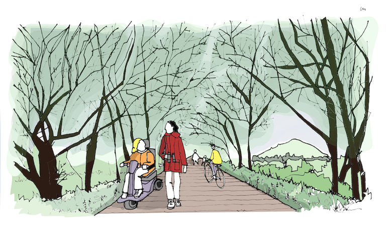

Connecting the two highest villages in Scotland, the 2.8km path will improve everyday walking, wheeling and cycling opportunities between the ex-leadmining communities, linking key community facilities including local businesses, Leadhills Primary School, satellite GP surgery, the community halls, the Museum of Leadmining and onward bus travel. It will provide accessible provision by foot and by wheel where there currently is none and forms part of the Southern Upland Way Link and Mennock Pass, popular with outdoor enthusiasts.
South Lanarkshire Council are co-ordinating proposals for speed reduction proposals and pedestrian / cyclist / accessible access within Leadhills village, creating safe access to the off-road route to the east of the B797. Project contractors Ironside Farrar are co-ordinating proposals for the off-road route into Wanlockhead which follows the existing path beside the Leadhills and Wanlockhead Railway. Proposals will follow Cycling By Design guidance.
The programme includes a package of Behaviour Change initiatives which will be delivered alongside and after the construction of the path, bespoke to the needs of the communities.
The project fits in with numerous national and local strategies concerning climate change, health and well-being, reducing inequalities, supporting sustainable economic growth and accessibility, including the national ambition that, "by 2030, Scotland's communities are shaped around people and place, enabling walking and cycling to be the most popular mode of travel for short, everyday journeys," (A Long Term Vision for Active Travel In Scotland 2030).
View the Concept Designs are as follows and are currently in review as part of Stage 3 Detailed Designs: page 1, page 2, page 3, page 4 and page 5.
The project is guided by a community Steering Group meetings. View previous minutes: 11.11.20, 23.02.21, 24.08.21, and 01.10.21.
Completed projects:
Make Your Way Fit For the Future, funded by Smarter Choices Smarte Places, *Auchrobert Community Energy & the Renewable Energy Fund.
We have developed a programme to run 15 events in 5 communities across rural Clydesdale (the wider project engaged with 12 communities) which promotes positive mental health and wellbeing by providing opportunities for people to connect, learn and share skills and knowledge locally. Our campaign brand review ultimately made it easier for even more people to choose to walk or cycle for short local journeys. We focussed on 5 core communities - Abington, Crawfordjohn, Douglas, Douglas Water and Leadhills - which will receive new community sited Active travel map boards (this did not happen in previous MYW programmes, for a variety of reasons - primarily Covid 19).
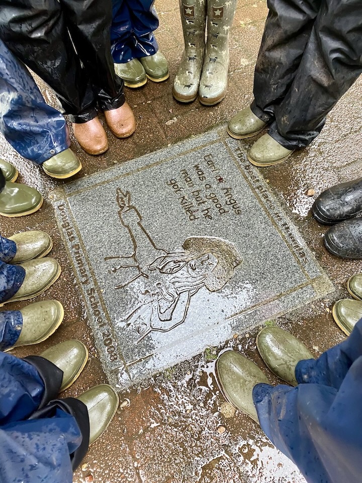
As part of this programme we invited Primary School pupils from Abington, Coalburn, Coulter, Douglas & Rigside to co curate a walking map of their area. These maps can be found here or download the Go Jauntly App to walk these routes!
Our innovative programme of 15 active and outdoor community mapping review events utilised our highly successful “walk and talk” (and cycle) map review event model developed during the delivery of our just completed Make Your Way programme in Lesmahagow, Blackwood, Kirkmuirhill and Boghead.
We ran a shorter programme of events in Carstairs Junction, Coalburn, Crawford and Elvanfoot, Glespin, Rigside and Coulter/Lamington to fully update MYW information there.
*Funding for Coalburn, Douglas, Douglas Water, Glespin and Rigside comes from Auchrobert Community Energy.
Make Your Way Blackwood, Boghead, Kirkmuirhill & Lesmahagow: Funded by Paths For All Smarter Choices Smarter Places which focussed on raising awareness of everyday sustainable travel options by a community sourced mapping process. The project delivered sustainable travel maps and community mapboard, cycling sessions and active travel workshops in the five local Primary Schools, Community Cycling Days and associated activities.
View the active travel maps and active travel resources for Abington, Blackwood, Carstairs Junction, Coalburn, Crawford and Elvanfoot, Crawfordjohn, Glespin, Douglas, Rigside and Douglas Water, Leadhills and Lesmahagow at https://makeyourwaylanarkshire.com
View the active travel maps for Carluke, Chatelherault Country Park, Glassford, Lanark, Larkhall and Stonehouse here.
View the Sustainable Travel Action Plans for Abington, Crawford and Elvanfoot, Crawfordjohn, Glespin, Douglas, Lamington, Leadhills, and Rigside and Douglas Water here.
View the Crawford and Elvanfoot Speed Reduction and Pedestrian Safety Feasibility Study here.
View the Glespin - Douglas Active Travel Pathway Feasibility Study here.

Contact
Contact the project team at